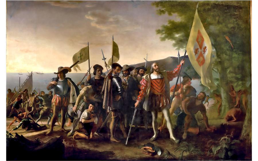
“Landing of Columbus”, by John Vanderlyn, 1846, Commissioned by Congress for the Capitol Rotunda
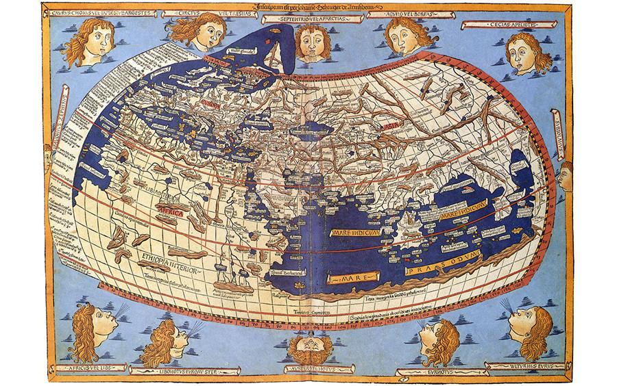
Between the 2nd and 15th centuries maps of the world looked like this…
By Johannes Schnitzer, Engraver and Claudius Ptolemy, Cartographer.
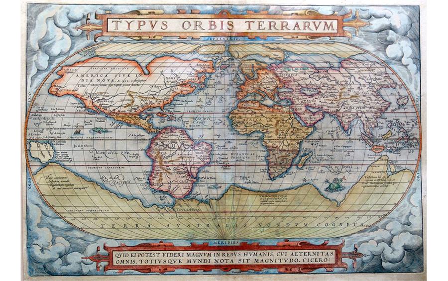
…but by 1570 the world view was far different.
“Typus Orbis Terrarum” by Abraham Ortelius, 1570
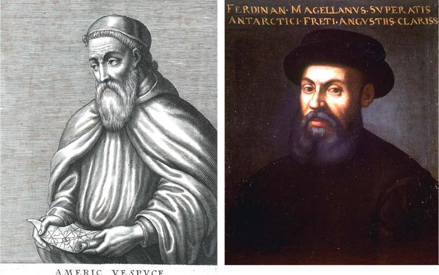
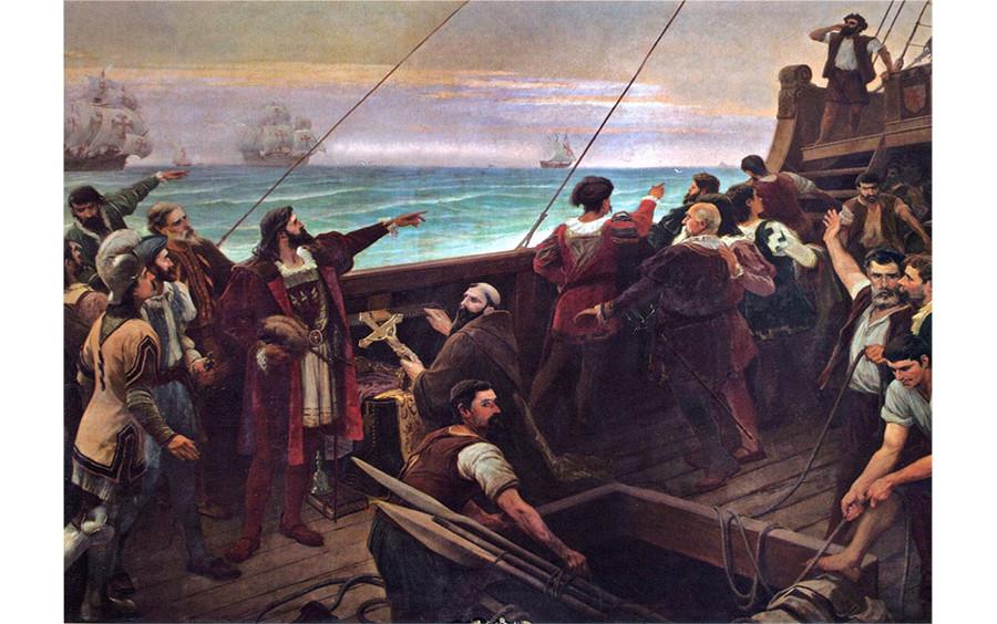
How did famous explorers such as Columbus, Magellan and Vespucci navigate their way across treacherous oceans to expand the world view so significantly?
Left, Portrait of Amerigo Vespucci. Right, An anonymous Portrait of Ferdinand Magellan. The Mariner’s Museum Collection, Newport News, VA.
Explorers during the Age of Discovery used elegant but now antiquated ships, rudimentary navigation devices, and their courageous spirits.
“Discovery of Brazil”, by Aurelio de Figueiredo, 1900 Museu Nacional de Belas Artes
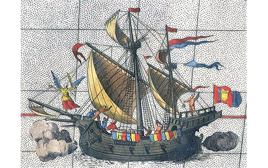
Some ship types used were Caravels, Carracks, and Galleons.
Ferdinand Magellan’s carrack, Victoria, was the only vessel that survived the journey. A Detail of Abraham Ortelius’ map, 1590
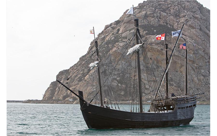
Caravels were small, fast, maneuverable vessels used during the 15th and 16th centuries. Columbus’ Niña and Pinta were both caravels.
Photograph of a replica of the Niña in Morrow Bay, California. By “Mike” Michael L. Baird, http://creativecommons.org/licenses/by/4.0/
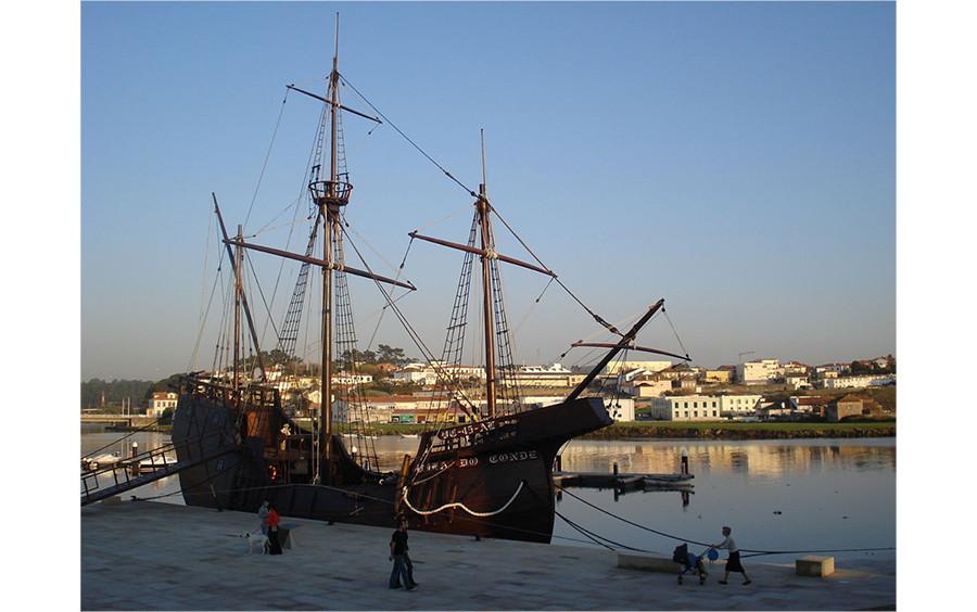
Carracks were larger ships, stable in high seas and roomy enough to carry cargo long distances. Columbus also had a carrack, the Santa Maria.
Replica carrack in Vila do Conde Portugal. Many mariners from this village voyaged during the Age of Discovery. By SergioPT, http://creativecommons.org/licenses/by-sa/4.0/
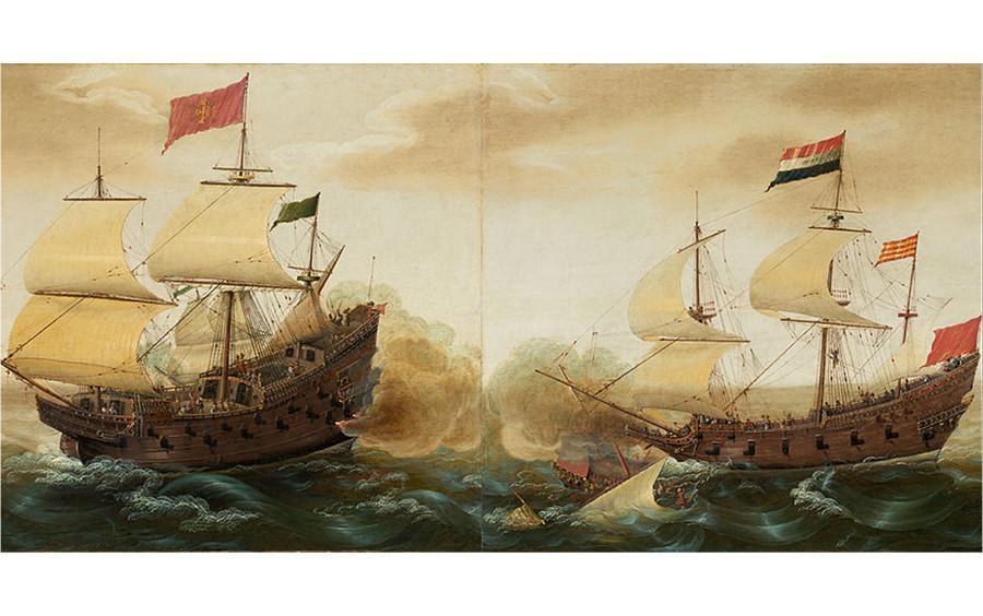
Galleons were multi-decked ships that came later than the caravel and carrack. They were faster, more stable, and more maneuverable than other ships.
Spanish and Dutch galleons engage in battle on the open seas. Part of “A Naval Encounter Between Dutch and Spanish Warships” by Cornelius Verbeeck, ~1619
Mariners used two primary methods of navigation during the Age of Discovery: Dead Reckoning and Celestial Navigation.
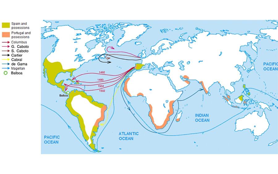
Age of Discovery, derived from Zámořské cesty Portugalců a Španělů.jpg, by Universalis, https://creativecommons.org/licenses/by-sa/4.0/deed.en
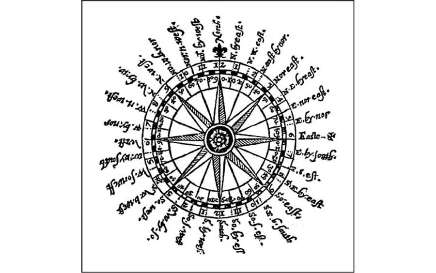
Dead Reckoning is calculating one’s current position by leveraging a known starting point. Mariners needed their compass heading, the ship’s speed, and the time spent travelling at each speed. The mariner’s compass shows direction.
A Mariner’s Compass. Davis, John, The Seaman’s Secrets. London: Thomas Dawson, 1607
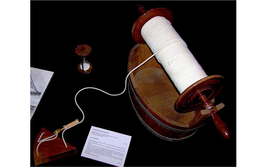
Chip logs were used to estimate speed. A chip log is a wooden board attached to a line with knots at uniform intervals. Sailors would drop it overboard and count the knots as the line spooled out. Nautical miles per hour are still measured in “knots”.
Photograph of a chip log, by Rémi Kaupp, https://creativecommons.org/licenses/by-sa/3.0/deed.en
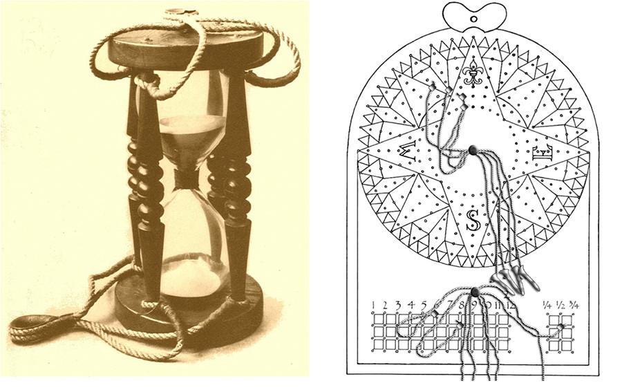
Navigators used hourglasses to track time intervals then recorded their time spent at each speed on a traverse board.
Left, Photograph of a marine sandglass, by Mcapdevila, https://creativecommons.org/licenses/by-sa/3.0/deed.en. Right, Drawing of a traverse board. SV Resolution at the English Language Wikipedia creativecommons.org/licenses/by-sa/3.0/deed.en
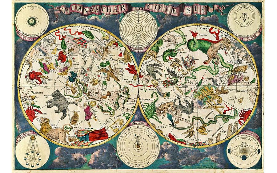
Celestial Navigation is a different method of determining location on the open water. Explorers used celestial angle measuring instruments to find their latitude. Finding longitude was still out of reach during this time period.
Planisphærium Cœleste, by Frederik de Wit, 17th Century
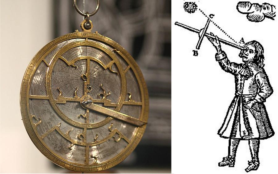
Instruments such as the cross-staff, quadrant, and mariner’s astrolabe were used to measure the angle between celestial bodies and the horizon, which revealed latitude. These instruments later developed into the back-staff, octant and sextant.
Left, Astrolabe from Jean Fusoris’ shop in Paris, ~1400 Photograph by Sage Ross, http://creativecommons.org/licenses/by-sa/4.0/. Right, A Jacob’s Staff (cross-staff) from John Seller’s book “Practical Navigation”, 1672
Explorers from the Age of Discovery pushed the limits of what people thought possible, overcoming incredible challenges and finding new lands all over the globe.
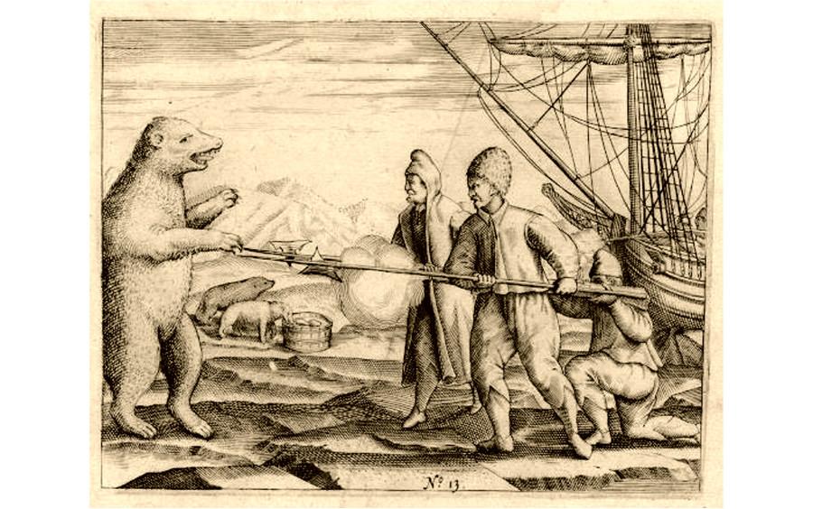
A polar bear approaches William Barentsz’ crew. From the diary of Gerrit de Veer, 1596
Metalphoto in the Marine and Shipbuilding Industry
Metalphoto of Cincinnati has been a leading full-service manufacturer of durable custom nameplates, panels, overlays, labels and signs for more than 50 years. We serve many industries, including the Marine and Shipbuilding industry.
Marine environments have always been, and will always be particularly brutal on equipment and their labels. Fading, corrosion and abrasion threaten the readability of identification items; impede safe operation, cost companies downtime, and can lead to regulatory fines. MPC’s Metalphoto® photosensitive anodized aluminum has been the material of choice for more than 50 years for items like load charts, control panel faceplates, component labels, and other durable identification items in marine environments. Metalphoto will always be the best choice for marine adventures of any kind.
Metalphoto of Cincinnati has been a leading full-service manufacturer of durable custom nameplates, panels, overlays, labels and signs. We serve many industries, including the Marine and Shipbuilding industry. For more information on MPC, our products, and the industries we serve please visit our website at old.www.mpofcinci.com.
Questions about the article? Let us help!
Our sales engineers are experts in automatic asset tracking, tagging and identification,a nd can answer all your questions. Get in touch now.
Create The Ideal Solution For Your Product Identification Needs
If you’re having trouble finding the ideal identification solution for your project or application, build it with Metalphoto of Cincinnati. Talk with our experienced sales engineers today.